6 The European Union
In a few short years the EU has become one of the most important European actors in space. When the Treaty of Lisbon entered into force in 2009, it gave the EU a space mandate for the first time. With the development of the Galileo satellite navigation programme and the Copernicus earth observation programme, the EU is about to become one of the world’s major satellite infrastructure operators. The EU’s growing involvement in space has captured the attention of European leaders. Once regarded as a relatively peripheral endeavour, done for its own sake, space activity has gained status over time as a means to achieve objectives in other policy fields – in particular, to promote growth and innovation. Space now has a place at the heart of European politics.
As the EU has gained influence in European space activities, ESA’s role in some areas has changed. ESA’s strength is that of a research and development organisation. The EU for its part has the political, financial and administrative muscle required to build and operate major infrastructure systems and hitch them to European policy objectives like economic growth, security, the environment and climate. In recent years we have seen a growing tendency towards a division of labour between the two organisations, with ESA developing basic infrastructure technology that the EU later funds and constructs for deployment. This was this model by which Galileo and Copernicus arose with considerable success. The future relationship between the two organisations has not been clarified. Some countries want to integrate ESA into the EU, as a EU agency, while others prefer to maintain the status quo. Regardless of the organisational structure that emerges, it is clear that many of the most important strategic decisions on European space activity in the future will take place in the EU by virtue of its size, its breadth of interest and its legitimacy in the eyes of member countries.
For Norway, the changing landscape affords both opportunities and challenges. On the one hand, the EU’s enhanced role has given Europe the ability to execute large and complex infrastructure programmes, such as Galileo and Copernicus. Norway will benefit greatly from these systems. On the other hand, Norway’s ability to promote its own interests may be challenged. The key decisions on European space activity are moving from ESA, where Norway is a full member, to the EU, where we are outsiders. This poses new challenges to Norwegian policy. Our space policy is becoming more like our other European policies, and we must find ways to make our voice heard on issues where EU space policy affects Norwegian interests.
6.1 The EU’s role in European space activity – background and trends
The EU’s role in European space programmes began to develop in the late 1980s, with the European Commission’s initiative to open up the European satellite communications market. At the time, this market was hampered by a complex regulatory regime in which rules varied from country to country. The complexity stifled competition and was seen as an obstacle to the effective use of satellite communications technology in Europe. It is worth noting that this issue went right to the core of the internal market, namely the potential for cross-border business activity and effective competition. Right from the start, then, the EU’s involvement in space touched on policy fields at the core of the EU project.
During the 1990s and 2000s, EU space activities became gradually stronger, primarily through close cooperation with ESA and through the EU’s framework programmes for research and development. The EU’s efforts were mainly aimed at developing space infrastructure and satellite-based services that would be helpful in achieving political goals in fields such as the environment, climate, transport and security. Since the late 1990s, the major pan-European infrastructure programmes Galileo and Copernicus have been the focal points of EU space activity and of EU-ESA cooperation.
As collaboration between the EU and ESA became more extensive, several initiatives were undertaken to formalise relations between the two organisations. The joint ESA-EU space strategy declaration of 2000 was intended to strengthen European space activity by establishing collaborative projects between ESA and the EU. In 2004, the two organisations signed a framework agreement. An important consequence of this agreement was that high-level EU officials began discussing space issues more frequently, including at regular ministerial-level meetings of a joint body known as the Space Council.
In the main, the early decades of the EU’s participation in space was characterised by ad hoc initiatives and cooperation with ESA to solve concrete problems. The EU had no formal mandate to implement its own space policies. This situation changed significantly when the Treaty of Lisbon entered into force in December 2009. The treaty gives the EU an explicit mandate to formulate a European space policy to support scientific and technical development, competitive strength and EU activities in other policy fields. To implement the policy, the EU is to establish appropriate relations with ESA and if necessary to take other measures, like creating a European space programme. But the Treaty of Lisbon provides no legal basis for trying to harmonise member states’ policies in the area; on the contrary, the text expressly exclude such initiatives.
As a step in carrying out the Treaty of Lisbon mandate, the EU issued a communication in 2011 titled «Towards a Space Strategy for the European Union that Benefits its Citizens». It contains three aims: public benefit, economic growth and a stronger EU role on the world stage. The aims of benefitting society and strengthening the European economy are familiar from previous EU initiatives in the area. Of more recent date is the explicit emphasis on the EU’s global status. This must be seen in the context of the EU’s heightened attention to security and foreign affairs (exemplified by the appointment of an independent high representative for security and foreign policy) and to the increasing emphasis on space infrastructure in these policy areas. Infrastructure in space is becoming a prerequisite for security on the ground. As a consequence, European capability has emerged as an important priority in it is own right, along with dialogue with major space actors like the United States, Russia and China.
The foremost characteristic of EU space strategy is its very strong orientation towards practical utility, with space activity defined as a means to achieve objectives in other policy areas. For many European countries, this implies a new way of looking at space. Traditionally, space activities have been regarded largely as basic research, albeit with significant side effects in the form of technological and industrial development. The basic premise of EU space strategy is that the space sector is to supply infrastructure, products and services critical to economic competitiveness, welfare and security in a modern industrial society. The clearest manifestations of such thinking are the space programmes Galileo and Copernicus.
Textbox 6.1 Industrial policy in the EU
From an industrial policy perspective, there are fundamental differences between ESA and the EU. ESA is a research and development organisation. The ESA convention calls for member countries to receive a timely share of projects and contracts in a proportion roughly equal to the payments they make to ESA – a policy of guaranteed industrial return.
The EU in principle has an industrial policy based on open competition among companies in the countries that participate in a given programme. This means countries have no «right» to get back contracts in proportion to the project costs they fund. EU industrial policy assumes that a country’s industry must be competitive. For small businesses, it is important to be active in the sub-supplier networks of prime contractors.
Since price is an important factor in winning contracts, countries with high costs face major challenges in securing contracts in open EU competition.
6.2 EU space programmes – common infrastructure, common goals
Most of the EU’s space-related activity takes place in the context of programmes whose aim is to develop and operate pan-European space-based infrastructure. By far the largest and most significant programmes to date are Galileo, the satellite navigation programme, and Copernicus, the earth observation programme. Through Galileo and Copernicus, Europe has in many ways stepped into a new era. In a few years, the EU will be managing space-based systems of a magnitude and complexity achievable by no one else but major powers like the United States, Russia and China.
Galileo’s development is among the largest collaborative industrial projects ever mounted in Europe. The system ensures institutional demand for Europe’s satellite navigation industry as well as European control and capacity in a service category of increasing strategic importance.
Copernicus will be an important tool for scientific research, public security and environmental and climate monitoring in Europe and around the world. Data obtained from the system’s satellites will be an important component of public services and a commodity for businesses that process satellite data. In addition to Galileo and Copernicus, the EU has engaged in space-related activities through framework programmes for research and innovation. Some EU officials have an ambition to establish programmes on such topics as space research and space weather.
6.3 EU satellite navigation programmes: Galileo and EGNOS
The EU channels its satellite navigation investments into the EGNOS and Galileo programmes, whose missions are to develop, operate and expand systems of the same names. EGNOS (European Geostationary Navigation Overlay Service) has been in operation since 2009. It verifies and corrects GPS signals (and eventually will do so for Galileo signals) so the signals are more reliable and precise. Galileo is to be an independent global satellite navigation system comparable to the American GPS, Russian GLONASS and future Chinese Beidou systems. Unlike the others, Galileo will be a purely civilian system. EGNOS and Galileo are being built and operated as separate systems, but are funded from the same EU budget line. Each must be viewed in relation to the other.
In the mid-1990s, the EU and ESA began collaborating on satellite navigation, initially by developing EGNOS. At the same time, preparations began for a future independent satellite navigation system. Development of Galileo got under way in 2001. For the rest of the decade, attempts were made to fund the construction and operation of Galileo as a public-private partnership between the EU, ESA and private investors. It proved impossible, however, to get private investors to assume financial responsibility, mainly because of the modest direct revenue potential and the high political, technological and financial risks. In 2007, therefore, the EU decided to fully fund the system’s development. The EU became the owner of the system with responsibility as well for its operation, maintenance and continued development. Construction was to be completed in 2013, but the project’s complexity and the late introduction of additional safety requirements have delayed the programme and raised costs. Galileo is now scheduled to enter early operational status in 2015. By 2020 the system is to be complete, with 30 satellites in orbit and fully operational services. The development of next-generation Galileo satellites is already underway.
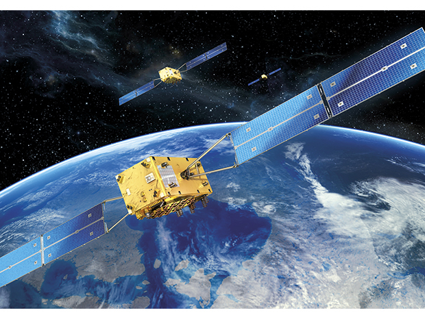
Figure 6.1 Galileo satellites
Source OHB System AG
The EU regards Galileo and EGNOS as tools to help develop Europe’s high-tech industrial capabilities and attain European self-reliance in a technology that is seen increasingly as a strategic priority. EGNOS consists physically of equipment installed on two satellites in equatorial orbit as well as a network of ground reference stations and four control centres. The signals from EGNOS can be received by most any GPS device, and are used to correct inaccuracies in the signals from these systems’ satellites. EGNOS provides three services: an open service that provides more precise measurement data than GPS alone, a service oriented to the aviation market for use during airport approaches, and a data service that supplies raw data and corrections through the Internet.
When fully developed, Galileo will be a fully operational, global satellite navigation system consisting of 30 satellites and 20 or so ground stations. It will provide the following services:
Galileo OS (Open Service), an open public service similar to today’s GPS as experienced by its civilian users.
Galileo PRS (Public Regulated Service), which will provide encrypted signals on dedicated frequencies. This makes the signal more resistant to disturbances and false signals, and makes it possible to regulate access. PRS will be offered to accredited users in the public sector.
Galileo SAR (Search and Rescue), which will detect signals and positioning data from emergency beacons and relay them to the international search-and-rescue system COSPAS-SARSAT. In contrast to existing services, Galileo SAR will include a return channel, by which the party in distress will receive confirmation that its emergency signal has been received.
Galileo CS (Commercial Service), which is still in the planning stages and is expected to provide high-precision services to professional users and signal-authentication for use in applications such as road pricing.
The construction and future development of Galileo and EGNOS provide assurance that Europe’s space industry will enjoy institutional demand for the satellite navigation technology. Such demand is a precondition for the very existence of the industry, given that foreign suppliers are barred from serving the (military) US, Russian and Chinese systems. In addition to the opportunity of supplying technology to satellites and ground infrastructure, Galileo and EGNOS give European companies and user groups early insight into, and influence over, programme specifications and technical systems. That insight is crucial for success in the growing market for products and services that exploit satellite navigation data, including intelligent traffic systems in the road sector, location-based smartphone applications and high-precision services for the maritime sector, the offshore oil and gas industry and agriculture.
By establishing Galileo and EGNOS, the EU achieves independent capability in a strategically important navigation technology. European demand for satellite navigation services so far has largely been satisfied by the US GPS system. While that system has met most European user needs, it is a military system outside European control. The Americans make no service guarantees and reserve the right to block signals if it would serve US needs. This has made it problematic to rely on GPS alone for critical services demanding high reliability, as in aviation. Moreover, dependency on another country’s military system has been deemed undesirable with regard to European foreign and security policy autonomy.
Galileo will be compatible with GPS in such a way that satellite navigation device users will be able to receive signals from both systems. Users will in fact perceive the two systems as seamlessly integrated. With Galileo and GPS working together, the number of satellites available to users at any given time will be about twice what would have been the case if there were only one system. That means improved access to satellite navigation services in polar regions, in deep valleys and in the midst of buildings in urban areas. The existence of two independent but compatible systems also means greater robustness and reliability for the services provided. One side effect of the EU’s investment in satellite navigation has been that it motivated the United States to improve its GPS system to meet the prospect of competition from Galileo. This was part of the reason US officials in 2002 chose to cease their intentional degradation of the civilian GPS service. The precision of the civilian GPS service improved overnight from 100 metres to 10 metres, a major benefit to users worldwide.
6.4 The EU earth observation programme: Copernicus
The EU invests in earth observation through the Copernicus programme, formerly known as Global Monitoring for Environment and Security (GMES). The primary purpose of this programme is to acquire information relevant to environmental and climate policy, ocean monitoring, research and security. Copernicus will collect data from earth observation satellites, airborne sensors and ground-based monitoring stations. It will also operate systems to process the data for different users. Copernicus represents a new phase in environmental monitoring by satellite. Until now, we have had to rely on individual research satellites with a limited service life. Copernicus by contrast will be an operative system providing continuous coverage, with replacement satellites going up as old ones are phased out. Such continuity is particularly important for the study of environmental and climate changes, work that requires repetitive observation over a long period of time. Thanks to Copernicus, Europe in 2015 will be operating the world’s most advanced fleet of environmental satellites. Europe already has a well-developed system of weather satellites. In the long run the programme is meant to be Europe’s contribution to the Global Earth Observation System of Systems (GEOSS). GEOSS will integrate data from different regional earth observation services to create a common platform, and will organise the information for different users. The goal is to develop a shared global infrastructure from which to obtain continuously updated information relevant to environmental management and disaster response.
Copernicus has its roots in international environmental and emissions agreements concluded in the 1980s and 1990s. With many countries committing themselves to emissions reductions and other environmental measures, there arose a need to document environmental conditions and monitor the extent to which countries lived up to their commitments. It soon became clear that the only effective way to do this would be to employ earth observation satellites. Against this background, the European Commission launched the idea of a pan-European initiative on earth observation in 1998, through a declaration called the Baveno Manifesto. A partnership was set up among the European Commission, ESA and the member states of the EU and ESA. In 2000, the partners began development work aimed at establishing an operational earth observation system for Europe. By 2010 they had progressed far enough to begin initial operations. The EU then adopted Copernicus as an EU programme, on par with Galileo and EGNOS. The initial operations phase, from 2011 to 2013, features the establishment of services based on data from existing national, commercial or ESA-owned satellites. The breadth of available data will be expanded considerably from 2013 onward, as the programme’s own satellites begin to orbit. As planned, Copernicus is to achieve fully operational status in 2014.
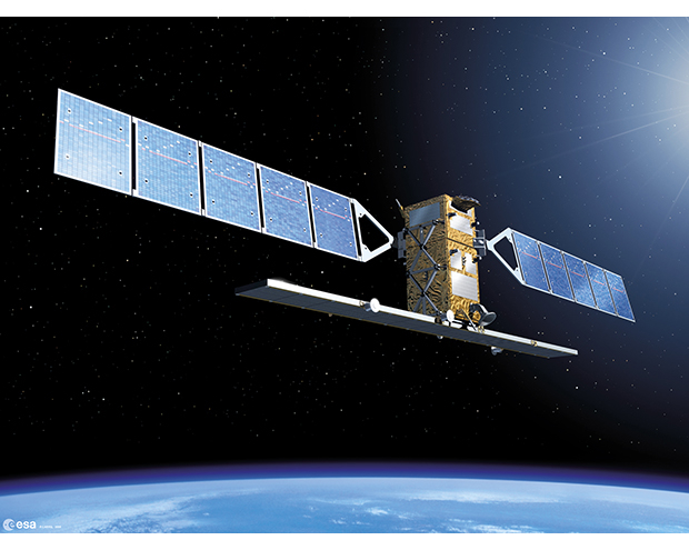
Figure 6.2 The Sentinel satellites will be part of Copernicus
Source ESA/P. Carril
Fully developed, Copernicus will consist of a large number of earth observation satellites in addition to land-based, ocean-based and airborne sensors. Some of the most advanced earth observation satellites, the Sentinels, are under construction and scheduled for launch in 2013. The programme will also use data from several existing satellites owned by ESA, the European weather satellite organisation EUMETSAT and the member states. Ground stations will also have to be set up to control Copernicus’ own satellites and receive data. The data provided by all this infrastructure will permit the gradual development of a wide range of services for European and international users. Copernicus programme services will be categorised as follows:
Marine environments: Monitoring in connection with maritime safety and transport, oil spills, water quality, polar environment, sea ice, oceanography and marine weather forecasting.
Land environments: Monitoring in connection with freshwater access, flood risk, agriculture and food security, land use, changes in vegetation, forest conditions, soil quality, urban planning and conservation.
Atmospheric services: Monitoring of air quality, long-range transboundary pollution, ozone, ultraviolet radiation and greenhouse gases.
Crisis situations: Services to aid response to natural and man-made disasters such as floods, forest fires, earthquakes and refugee flows.
Security: Support for border control, maritime surveillance and protections against terrorism and international crime.
It is the EU’s stated goal that Sentinel satellite data and the core services, which are to be freely and openly available, will give rise to significant commercial activity and innovation in downstream service markets. In other words Copernicus, while directly addressing significant challenges related to public administration, the environment, climate and security, is also supposed to stimulate commercial growth and innovation.
Textbox 6.2 The Sentinel satellites
At the core of Copernicus are the Sentinel environmental satellites, which will move in low earth orbit over the poles. Their continuity, predictability and sensory capabilities should satisfy important environmental monitoring needs, especially when it comes to data of global and international significance. The satellites are to be launched between 2013 and 2019. Six different categories of satellite are planned:
Sentinel 1: Radar-imaging satellites capable of observing land and sea areas regardless of light conditions. These satellites will be particularly useful for ocean monitoring and landslide hazard detection.
Sentinel 2: Satellites designed to provide images over land and coastal areas. These images will have particular value in the monitoring of forests, soil and freshwater bodies, and in support of emergency services.
Sentinel 3: Satellites combining radar with optical sensors to be used for ocean monitoring and environmental monitoring over land.
Sentinel 4 and 5: Satellites able to discern the chemical composition of the atmosphere.
Sentinel 6: Satellites designed to take precise elevation measurements, to be used in determining changes in sea level.
6.5 Norwegian participation in Galileo, EGNOS and Copernicus
Norway’s participation in Galileo, EGNOS and Copernicus has evolved gradually over the past two decades. In all three programmes, Norway was an early participant in developing technology and instruments, first through ESA and later through a cooperative arrangement with the EU under the European Economic Area agreement. Our participation has given us the opportunity to influence the programmes, so that they serve Norwegian interests to the degree possible. Norwegian companies and public authorities have gained early insight into the programmes, strengthening Norwegian players in the market for services and products that rely on satellite navigation and earth observation. Early insight has also made it possible for Norwegian public officials to identify ways the programmes could help improve public services. To date, Norwegian space-related industrial concerns have won contracts in the programmes totalling about 130 million euros.
Galileo and EGNOS
Norway has been involved in constructing the Galileo and EGNOS satellite navigation systems since work on the programmes began in the 1990s, first through ESA and later in cooperation with the EU. Norway has contributed 13 million euros to the programmes through ESA and 72 million euros through the EU. Through its participation, Norway is helping to construct pan-European infrastructure that will be of great benefit to Norway. Active Norwegian participation in the satellite navigation programmes makes it easier for Norwegian authorities, industries and enterprises to influence matters affecting coverage area, access and use of services. Norway’s participation also helps the country’s industries, companies and organisations gain access to the technology and expertise they need to exploit the opportunities that Galileo provides. This is fertile ground for developing competitive services and technologies with commercial promise that can be of particular support to users in Norwegian industry and public administration. An important aspect of participation in the Galileo and EGNOS programmes is the opportunity it represents to make sure those systems perform capably in Norwegian areas, particularly in the far north. Norway has worked actively – and successfully – in the Galileo and EGNOS governing bodies to improve system performance in the High North.
The Norwegian Storting approved Norway’s participation in Galileo and EGNOS in 2009. The two European legislative acts that regulate the satellite navigation programmes were incorporated into the EEA agreement by decision of the EEA Joint Committee on 8 July 2009. The acts incorporated were:
Regulation (EC) No. 683/2008 of the Parliament and the Council of 9 July 2008 on the further implementation of the European satellite navigation programmes (EGNOS and Galileo)
Council Regulation (EC) No. 1321/2004 of 12 July 2004 on the establishment of structures for the management of the European satellite radio-navigation programmes
Respectively, the acts deal with the construction of Galileo and the programme’s funding through 2013 (No. 683/2008) and with the establishment of the GNSS Supervisory Authority, or GSA (No. 1321/2004). The act concerning the GSA was later replaced by a new one, which was itself incorporated into the EEA agreement by decision of the EEA Joint Committee on 15 June 2012:
Regulation (EC) No. 912/2010 of the European Parliament and of the Council of 22 September 2010 setting up the European GNSS Agency, repealing Council regulation (EC) No. 1321/2004 and amending Regulation (EC) No. 683/2008
Apart from the acts incorporated into the EEA agreement, a bilateral agreement has been signed with regard to aspects of Galileo and EGNOS that do not naturally belong in the EEA agreement, including security, ground facilities, protection of frequencies and export control. Exchange of classified information related to the programmes takes place in the context of Norway’s security agreement with the EU. Norway has committed itself financially to participate in Galileo and EGNOS until the end of 2013. Further Norwegian participation in the programmes, beyond 2013, would require a decision by the Storting.
Norway’s participation in Galileo and EGNOS permits the country to sit in the programmes’ governing bodies. As with other EU programmes, Norway lacks voting power, but our right to speak out and participate in other ways gives us considerable influence in the specialised bodies that govern Galileo and EGNOS.
Taking part in Galileo and EGNOS has resulted in contracts for Norwegian industry and the creation of satellite navigation infrastructure on Norwegian territory. Since 2003, Norwegian companies have won Galileo- and EGNOS-related contracts valued at some 79 million euros. Three Galileo sensor stations have been established on Norwegian territory – at Svalbard, Jan Mayen Island and the Troll research station in Antarctica. There is also an uplink station on Svalbard for navigational data, and a receiving station is being planned for the search-and-rescue service that underpins COSPAS-SARSAT. Additionally, EGNOS reference stations have been established at Svalbard, Jan Mayen Island, Kirkenes, Tromsø and Trondheim to ensure good coverage across Norwegian areas. The stations are run by Kongsberg Satellite Services and the Norwegian Mapping Authority. Galileo ground stations and EGNOS reference stations are part of the ground segment that monitors overall system performance and generates navigational data. The performance of EGNOS is steadily improving in northern latitudes. It is hoped that EGNOS will become a useful tool for pilots approaching airports in all of mainland Norway.

Figure 6.3 EGNOS will contribute to safer airport flight approaches
Source Markus Mainka/123RF
Copernicus
Norway helped develop the technology that underpinned the establishment of Copernicus, first through ESA and the EU’s Seventh Framework Programme for Research (FP7), and since 2012 through the EEA agreement. The total Norwegian financial contribution to Copernicus through 2013 amounts to approximately NOK 227 million. In part because of Norway’s early involvement in Copernicus, Norwegian authorities, industries and businesses today are able to influence the programme. It is important for Norway to ensure that Copernicus performs well over areas of Norwegian interest. Good performance, from Norway’s perspective, refers to good geographic coverage of areas administered by Norway as well as the fine-tuning of satellites to generate the earth-observation data that is most relevant to this country. Norway is one of the nations assumed to benefit most from the data and services Copernicus will offer. Not only do satellites in polar orbit provide coverage that’s twice as good in our areas than further south, but we have vast expanses of sea and land to cover. The programme is expected to be an important data source for many Norwegian users, including national initiatives such as BarentsWatch. Participation will also result in a level playing field for Norwegian companies competing to supply the programme. Norwegian players are expected to be able to provide things like ground station services and the development of services using earth observation data. Norwegian participation is also considered a contribution, in solidarity with other nations, to the development of global earth observation capacity.
Norway formally became a participant in GMES (as it was then called) in 2012. The EU’s regulation of GMES was incorporated into the EEA agreement by decision of the EEA Joint Committee on 13 July 2012, and was approved by the Norwegian Government in the Council of State on 12 October 2012. The regulation incorporated was:
Regulation (EC) No. 911/2010 of the European Parliament and of the Council of 22 September 2010 on the European Earth monitoring programme (GMES) and its initial operations (2011 to 2013)
This regulation is to pave the way for a full-scale operational programme starting in 2014. Norway’s approval of the regulation gives us the right, but not the obligation, to participate in Copernicus after 2014. Norwegian participation in Copernicus beyond 2013 would require action by the Storting.
Participation in Copernicus has resulted in contracts to Norwegian industry and opportunities to influence the services to be provided. So far, participation in the programme has returned contracts worth 51.5 million euros. In the initial phase of operations, Kongsberg Satellite Services has been awarded a framework contract valued at NOK 200 million to provide ground station services in Svalbard for five years. Kongsberg Spacetec, based in Tromsø, has supplied advanced signal processing equipment to ground stations serving the Sentinel satellites. Other Norwegian companies, too, have contributed to several of the satellites. Within the EU’s FP7 programme, meanwhile, a number of Norwegian research institutions have had a hand in specifying services related to marine environments and atmospheric services. The Norwegian Meteorological Institute has been a central Norwegian participant on the service side with regard to both sea and atmosphere, ensuring that important public administration interests are safeguarded.
6.6 What does the EU’s expanded role mean for Norway?
The EU’s activity in space has major consequences for ESA and for the countries of Europe. In the course of a few years, ESA has gone from being the undisputed forum for pan-European space activity to being challenged by an EU with rising ambitions. The EU has made it possible to execute large infrastructure programmes that ESA would never have been able to manage alone; yet the EU also represents a challenge to ESA’s role as an independent organisation. In countries with membership in both the EU and ESA, governmental focus on space has broadened as space-related issues rise to higher levels of political discussion in a greater number of policy areas. This gives space activities greater political weight, but it complicates national and European decision-making processes. Norway, one of only two ESA members not in the EU (Switzerland is the other), is in a unique position. On the one hand, the EU’s strengthened role has led to the development of infrastructure from which Norway will benefit greatly. Galileo and Copernicus will help to solve major Norwegian challenges, many of them related to the High North and to Norwegian climate and environmental policy. On the other hand, influence is shifting from an organisation in which Norway is a full member to an organisation that obliges us to try to be heard while standing outside. As the EU expands its role, Norway’s space policy naturally takes on aspects of the country’s overall European policy.
The relationship between the EU and ESA to date has been characterised by a divvying of tasks, with ESA conducting research and development and the EU funding and carrying out the construction and operation of satellite-based systems. This arrangement has benefitted both parties and expanded Europe’s capacity to develop space infrastructure serving public interests across national boundaries. It is unclear how the relationship between the two organisations will develop in the years to come. The European Commission has expressed increasing resistance to the idea of ESA issuing guidelines that may have bearing on the EU’s own political priorities. On several occasions, leading EU countries have called for stronger integration between the two organisations – for example, by incorporating ESA into the EU as an agency comparable to the European Defence Agency. Other important EU members have aligned against such a proposal. Whichever structure emerges, many of the most important strategic decisions about European space activity in the years ahead will be taken in the EU, by virtue of the organisation’s size, its breadth of interests and its legitimacy in the eyes of member countries.
In the years ahead, Norway’s effect on the developing relationship between the EU and ESA will be limited. However, there is much we can do to safeguard Norwegian interests, regardless of how European space activities are organised. First, we can contribute constructively to ESA’s further development, so the agency can continue, to the extent possible, to be a strong and independent a partner for the EU. If despite that effort ESA seems likely to face assimilation into the EU system, it can be surmised that Norway would seek to negotiate an agreement on participation. A strong Norwegian role in ESA in the meantime will strengthen our ability to negotiate an advantageous agreement. Second, it will be important to position Norway in near relation to EU space programmes and to take a proactive approach to developments in EU space policy. In our dealings with Galileo and Copernicus, we have seen that active participation in EU space programmes affords plenty of scope to advance Norwegian interests. Norway has earned a reputation as a competent and constructive partner, and the European Commission has repeatedly emphasised that the EU desires Norwegian participation in such programmes. Even without voting rights, our participation in the governing bodies and working groups of Galileo and Copernicus has proved to be a powerful means of addressing special Norwegian interests, and of obtaining early insight into programme capabilities and specifications. We have also seen that we can be excluded, without much ado, from important decision-making processes when we are not sufficiently committed to active participation. In 2011, when Copernicus became an EU programme after having been under ESA control, Norway lost the right, previously granted through ESA membership, to take part in meetings of the programme’s governing bodies. Only in 2012, when Norway signed a special agreement with the EU to participate in Copernicus, did we regain our right to join the meetings.