5 Integration into National Airspace
Norwegian authorities are actively working to enable the safe and effective integration of drones and AAM solutions into its national airspace. This transformation is driven by emerging technologies, increased demand, and the diversification of airspace users. As always, aviation safety remains the highest priority.
A core objective of the authorities’ approach is to ensure that drones can operate safely alongside manned aviation. Achieving this requires a combination of new digital infrastructure, procedural frameworks, and regulatory tools – particularly in the lower airspace where drone operations are most concentrated.
While controlled airspace is actively managed by air traffic control services, much of the lower airspace remains uncontrolled. In these areas, traditional «see and avoid» principles are no longer sufficient due to the increasing volume and complexity of unmanned operations.
The government recognizes the need to modernize systems for traffic coordination, flight awareness, and risk management. New procedures and digital tools are being introduced to support both manned and unmanned operations while safeguarding existing airspace users and uses, including those related to national security and civil protection.
The Norwegian Airspace Strategy adopted in 2021 outlines how the growing number of airspace users – particularly drones – creates new demands on capacity and coordination. The 2021 strategy introduced a purpose-based prioritization model for access to airspace, ensuring that the function and urgency of an operation take precedence over whether an aircraft is manned or unmanned. However, legacy systems and practices still often assign drones the lowest operational priority, particularly in controlled airspace near airports.
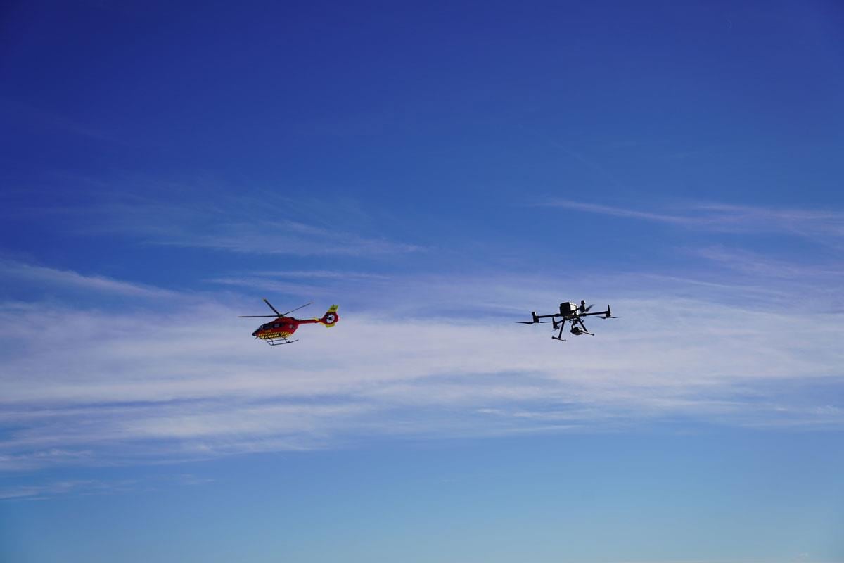
Figure 5.1 Concurrent use of airspace
Photo: Avinor AS
To address this, Norwegian authorities are working to establish predictable and equitable procedures for access to both controlled and uncontrolled airspace. This includes exploring technology-neutral frameworks and flexible scheduling arrangements – especially for operations in close proximity to urban centers or essential infrastructure.
Norway has implemented the U-space regulation (Regulation (EU) 2021/664), which introduces designated airspace volumes where complex drone operations can be conducted safely and simultaneously through certified digital services. These services will be provided by authorized U-space service providers (USSPs) and coordinated via a Common Information Service (CIS).
The Norwegian Air Navigation Service Provider – Avinor – has been designated as Common Information System (CIS) Provider. The government expects initial U-space airspaces to be launched in research and innovation contexts, followed by limited commercial deployments in high-demand areas such as logistics hubs and industrial zones.
To improve visibility and coordination across all airspace users – not only in U-space airspaces – the government has introduced a framework for a Digital Integrated Aeronautical Information Service. This system will consolidate information about flight restrictions, dynamic no-fly zones, airspace structures, and operational intentions from a range of civil and military sources.
The solution aims to ensure that all airspace users – manned or unmanned – can access timely and relevant information through a single digital interface. The services is also intended to support law enforcement, environmental oversight, and emergency response by providing a baseline understanding of typical airspace usage, thereby helping to identify irregular or potentially harmful drone activity.
A key enabler of safe integration is electronic conspicuity – the digital visibility of all aircraft in the airspace. The government foresees a phased introduction of mandatory conspicuity requirements, focusing first on drones flying beyond visual line of sight (BVLOS) or above certain altitude thresholds. The government is also considering standards such as ADS-L, a simplified alternative to ADS-B for unmanned aircraft.
Remote identification technologies, both direct (e.g., Bluetooth or Wi-Fi-based) and network-based, are being explored as additional layers of safety and accountability. The authorities are aware of privacy concerns and are working to ensure appropriate protections and operational exemptions, especially for sensitive government missions.
To provide legal and operational clarity, UAS geographical zones will be established and published digitally. These zones – introduced with Regulation (EU) 2019/947 – may restrict or regulate drone activity based on safety, security, privacy, or environmental criteria. A central challenge lies in collecting, harmonizing, and disseminating spatial data from multiple public authorities responsible for these areas. Norwegian authorities is currently assessing the legal and administrative frameworks needed to support this coordination.
The development and operation of digital services, including CIS and the Digital Integrated Aeronautical Information Service, will incur significant costs. Norway is evaluating financing models that reflect user benefit and fair cost-sharing, while safeguarding access to uncontrolled airspace for new and existing users. Drone operators are expected to bear a significant share of the cost, but fee structures may be differentiated to ensure proportionality and avoid undermining innovation or public interest applications.
The government's approach is grounded in the principle of stepwise implementation. Recognizing the rapid pace of technological change and the unpredictability of market developments, the government aims to implement solutions incrementally – solving the most pressing challenges first, then expanding capabilities over time.
As the drone sector evolves from isolated test environments into scaled operations across a variety of sectors, ensuring fair access to airspace and high safety standards will remain a national priority.
To ensure safe, efficient, and integrated use of Norwegian airspace for both manned and unmanned aviation, the government commits to:
- Prioritizing airspace access based primarily on the purpose of the activity, regardless of whether the aircraft is manned or unmanned
- Evaluating whether access to airspace for drone operations near airports should be made more flexible
- Assessing the need for new or clarified procedures in uncontrolled airspace that consider beyond visual line of sight (BVLOS) operations and electronic conspicuity technologies
- Facilitating the establishment of U-space airspaces in Norway
- Investigating whether all low-altitude flights should be subject to mandatory registration in the Digital Integrated Aeronautical Information Service
- Reviewing the appropriate distribution of responsibilities among various actors when establishing UAS geographical zones, including who should be responsible for publishing the zones
- Assessing whether the Civil Aviation Authority should be assigned a coordinating role to ensure consistent management of the creation, modification, and removal of airspace structures in Norway
- Evaluating which areas, if any, should be exempt from publication as UAS geographical zones due to safety or practical concerns, such as the presence of military vessels or other security-critical areas
- Reviewing existing legislation and, if necessary, proposing new legislative tools to mandate the submission of mapping data to a centralized notification service
- Enabling the development and deployment of electronic conspicuity solutions aimed at achieving full integration between manned and unmanned aviation
- Examining whether, and to what extent, electronic conspicuity should be mandated for airspace users who are not currently subject to such requirements